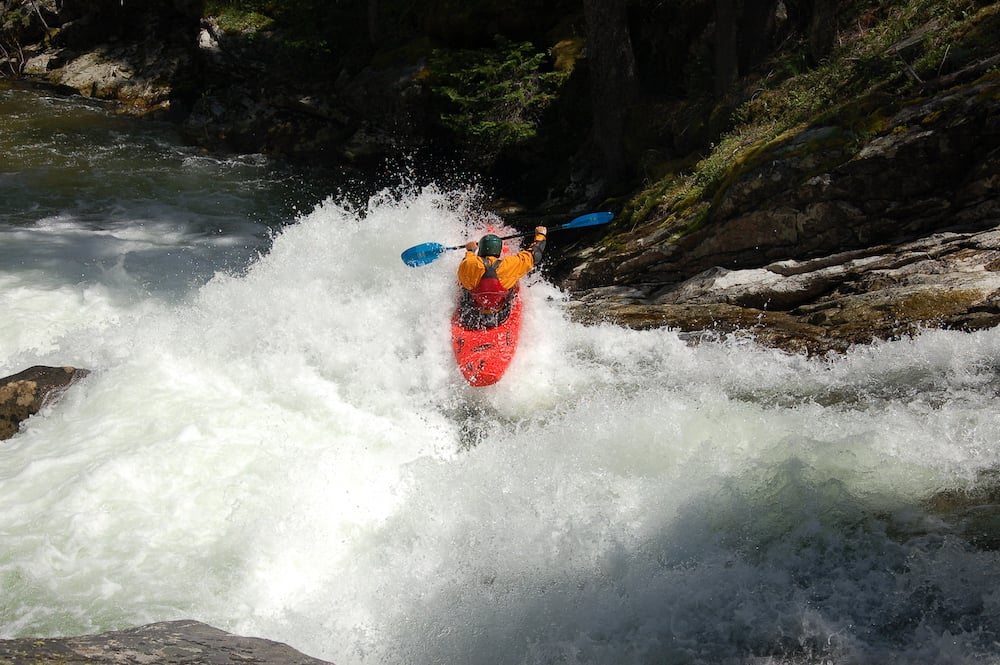
Explore Northern Rockies Rivers with Purpose This Year
Documenting your experiences on rivers in the Northern Rockies this summer could help secure lasting protections for those rivers. Several key landscapes are under review for protections by Congress and the US Forest Service, but we lack the kind of compelling descriptions and photos that can inspire and inform decision makers to offer rivers and their enjoyment key protections. So we need your help. As you explore rivers in the focal areas noted below, we encourage you to paddle with a purpose: take photos highlighting river values, take video, and take notes on recreational and ecological values - then share your content with American Whitewater.
Yellowstone and Smith River Watersheds, Montana
The Montana Headwaters Legacy Act awaits reintroduction and we need photos, river descriptions, and any other media content to help secure the bill’s reintroduction and passage. Check out the map and list of rivers in the bill, and help us document these rivers’ outstanding values. Nearly all the rivers in the bill feature whitewater runs, and while the AW rivers inventory is geographically pretty complete, we need better photos and content.
Wind River Range, Wyoming
The Bridger Teton National Forest, located immediately south of Yellowstone National Park and on the west side of the Wind River Range are in the early stages of developing a new Forest Plan. Part of that process is inventorying potential Wild and Scenic Rivers that will be protected as “eligible” for designation in the new forest plan in order to protect their documented exceptional values like recreation, scenery, and wildlife. The AW rivers inventory is very incomplete. We need photos and descriptions to advocate eligibility protections.
Lolo Bitterroot National Forest - Montana
Located around Missoula, the Lolo Bitterroot National Forest will start Forest Plan revision within the next couple years. Like the Bridger Teton described above, photos and descriptions of what makes specific stream values rare, unique or exemplary are needed. Our rivers inventory is somewhat complete in this region. This is a great opportunity to protect some rivers near and dear to folks in Western Montana!
Crown of the Continent Area - Montana
While National Forest planning was recently completed in this area and was successful, we continue to work on a companion bill to the Montana Headwaters Legacy Act that will include this region south of Glacier National Park, which includes the Flathead watershed, and portions of the Rocky Mountain Front and Bob Marshall Wilderness complex. Check out the rivers on our Crown of the Continent proposal map and help us share how awesome these rivers are with decision makers.
How to Contribute Photos and other Content:
River enthusiasts have a couple options for chipping in. First,
you can email your content to Jim Hepburn, jim@americanwhitewater.org. Alternately, you can
add photos and descriptions to the relevant river pages in the AW river
inventory, and then let Jim know via email. If there
is no river page for a run and you think there should be, let us know and we'll create one for
you to populate.