AW Wildfire Info Map Keeps Boaters Updated on Rivers Affected by Fires
It's mid-summer and for much of the country that means it's prime boating season. For some areas, particularly the West, it's also fire season. This means that in addition to checking flows and weather before going boating, it's a good idea to also check for any wildfires, smoke, or closures that may impact your plans. We've built a map to help you with the fiery aspects of trip planning and safety.
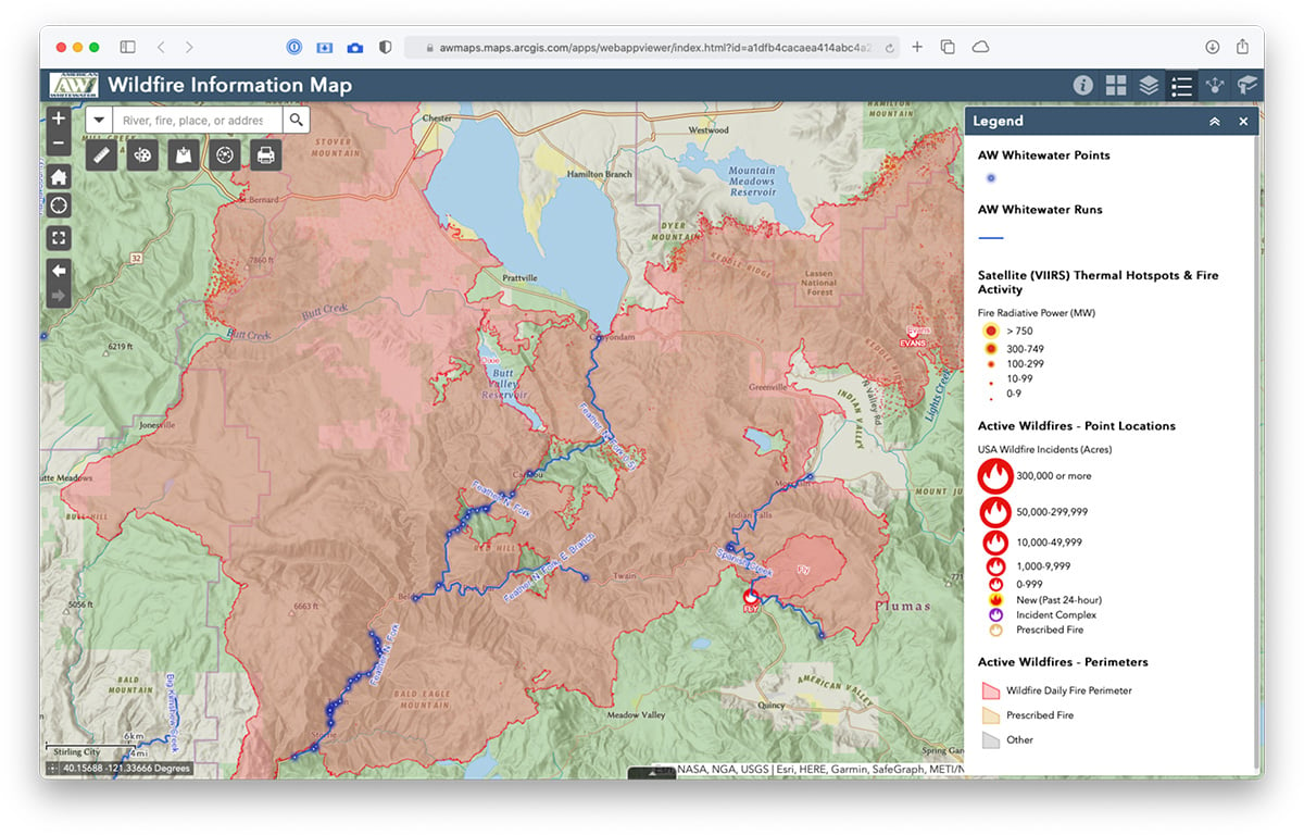
The American Whitewater Wildfire Information Map show all the runs in our National Whitewater Inventory along with the latest wildfire information. The map loads with rivers and fires shown by default but there is much more information available by selecting additional map layers in the menu on the top right. This includes smoke and air quality info, live AlertWildfire webcams (where available), past fire history, US Forest Service closure areas (WA & OR only), and more.
Maps can be easily shared, customized and printed, and other tools allow measurements, drawing, and more. Click the (i) button in the top-right blue header for complete instructions.